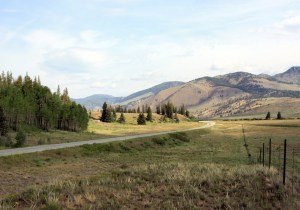
Rio Grande River Valley, on the way to Creede, Colorado.
Saturday, July 14, 2012 was the sixth day of my trip through Colorado’s mining history. I started in South Fork and travelled through Creede, Lake City, Gunnison, Buena Vista, and finally wound up near Victor. It was a long drive, but I stopped for some interesting tours and explorations along the way.
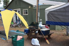
Campsite at South Fork. There wasn’t much privacy.
My campsite in South Fork was very tiny and right next to the community center and I was trying to cook breakfast and break camp as people literally walked through my camp to set up a bake sell in the common room. Here’s a photo to show it. The tent trailer next to me almost hung over my picnic table. But despite the lack of privacy, I did manage to get packed up and ready to go at a reasonable time.
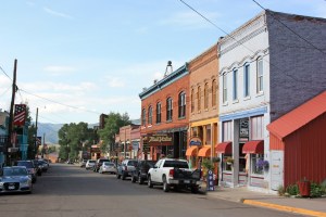
Main Street in Creede, Colorado.
I drove north on Highway 149 toward Creede, following the Rio Grande River. The valley here is wide and flat, the obvious result of valley glaciers during the last ice age. Going back much further than that, about 60 million years ago, the Farallon tectonic plate was pushing under the North American Plate at a faster rate than normal, wrinkling up the western part of the continent like a rug on a wooden floor. The last great orogeny (mountain building episode) pushed up the Rocky Mountains and was called the Laramide Orogeny. The San Juan Mountains, which I have been exploring all week, were the final uplift and are the youngest mountains in Colorado. Eventually, the North American Plate slowed down and the Farallon Plate finally subducted beneath. As it pealed away, a wave of volcanic activity followed it as the melting plate became magma that rose to the surface.

Volcanic Activity in the San Juan Mountains.
In the newly formed San Juans, the rising magma created a system of andesitic volcanoes that exploded and spewed ash and tuft throughout the region. The empty magma chambers collapsed to form calderas, and around their rims veins of ore-bearing igneous rocks were injected into fault lines and cracks. These veins became the great silver and gold mining districts I’ve visited all week.
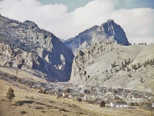
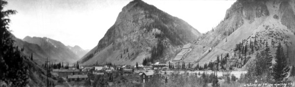
Creede, Colorado in 1942.
In the area of Creede, about five overlapping calderas exploded and collapsed; silver-bearing ore was injected into fractured rock at the edge of the caldera. In 1889, these silver deposits were discovered and began the final great silver mining camp in Colorado. It was the fastest, wildest, and richest of the boomtowns and the population reached 10,000 by 1891.

Creede Main Street looking north into Willow Creek Canyon.
Denver went through a wave of gambling and saloon reforms in the early 1890s, and many of the most famous casino owners and con men moved here to set up shop, including Jefferson Randolph “Soapy” Smith II. He sold his Tivoli Club in Denver and moved to Creede. He swindled local property owners out of their deeds and took over a large section of Creede’s business district, setting up his gang in various fronts for his confidence schemes. He soon announced himself as camp boss, and controlled all of the gambling and organized crime in the district. He appointed his brother in law as deputy sheriff, and the two of them established some order to the rough and tumble town, throwing out troublemakers. Soapy opened up a gambling hall called the Orleans Club in 1892. He purchased a “petrified man” nicknamed McGinty and had him placed on display.
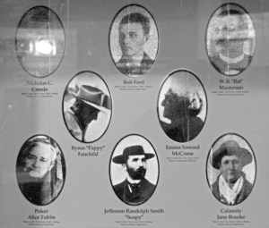
Cast of Characters in Creede, Colorado.
Later in 1892 he got word that the reforms in Denver were coming to an end, so he returned to Denver. Shortly after, a large part of Main Street burned down in a fire, including the Orleans Club.
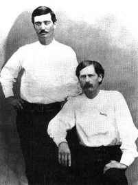
Bat Masterson (standing) and Wyatt Earp in 1876, when they were deputies in Dodge City, Kansas.
Another well-known figure that came to Creede was Robert Ford, the man that shot Jesse James. He arrived in early 1892 and set up a dance hall, but after a drunken night spent shooting windows out along Main Street, he was about to be driven out of town when the Soapy Smith gang insisted that he stay. Ford’s dance hall was burnt down in the fire on June 5, 1892 and he set up a temporary saloon in a tent until he could rebuild. Three days after the fire, on June 8, Edward O’Kelley walked into the saloon, called Ford by name, then shot him twice in the chest with a shotgun. Ford died instantly.
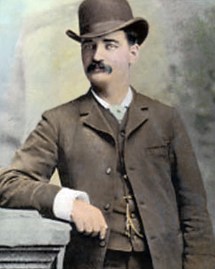
Bat Masterson
Another famous Old West character that found his way to Creede was William Barclay “Bat” Masterson. In his early days, he was a deputy sheriff in Dodge City, Kansas, along with Wyatt Earp. Bat eventually became county sheriff, at the same time that his brother, Ed, was town marshal. When Ed was killed by a cowboy named Jack Wagner, Bat avenged his death and had to leave town. He went to work for Wyatt Earp in Tombstone, Arizona running the faro tables at the Oriental Saloon.
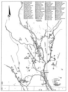
Map of mines in the Creede Mining District.
When Bat’s other brother, Jim, was threatened by men in Dodge City, Bat returned and engaged in a shootout in the town plaza where one man was wounded. Bat was fined $8 and asked to leave town again. He moved to Denver where he dealt faro at a gambling house and became friends with Soapy Smith. He moved with Soapy to Creede in 1892 and managed the Denver Exchange Club until it, too, burned down in the fire. Bat was known for being a dapper man who enjoyed wearing a bowler hat. He was also known as an irrepressible practical joker.
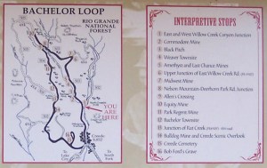
Map of the Bachelor Loop scenic trail north of Creede.
Other characters that stopped by Creede during its boom years were “Poker” Alice Tubbs and Martha “Calamity Jane” Burke.
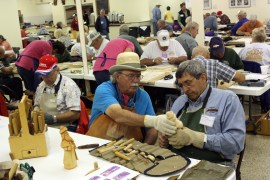
Woodcarving lessons in the Creede Community Center.
As if the 1892 fire wasn’t bad enough, in 1893 the Sherman Act was repealed by congress and the Silver Panic began, with prices for silver dropping from $1.29 to about $.50 per ounce. Almost as soon as it began, the boom was over and Creede began to die. Most mines closed, but a few kept working and others consolidated until 1930, when all mining ceased. Some additional mining occurred in the late 1930s by the Emperius Mining Company, and the Bulldog Mountain vein system was discovered in the 1960s, with mining along the vein conducted by the Homestake Mining Company until 1985. Overall, nearly 5 million tons of ore have produced over 84 million ounces of silver and substantial amounts of lead, zinc, copper, and gold (the big five).
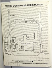
Creede Underground Mining Museum map. The mine tour and community center were blasted out of the side of Willow Creek Canyon.
Some of the leading mines were the Bachelor Mine high up in a notch in West Willow Creek Canyon, the Commodore Mine lower down the same vein, the Amethyst Mine further up the canyon, the Last Chance high on the hill above the Amethyst, and the Bulldog complex to the west of Willow Creek. A large mill, called the Humphreys Mill, was located at the junction of East and West Willow Creek Canyons. The mill’s foundations can still be seen. The earliest mines in the district were discovered west of town around the Sunnyside area, such as the Solomon and Holy Moses mines. The town cemetery is located there now.
Model of the Bulldog Mine.
After looking around Main Street, I drove further up the canyon to where the Creede Undergound Mining Museum and community center are located. I was surprised to see a lot of cars filling up the parking lot, and was lucky to find a place to park. A large woodcarver’s convention was being held in the community center, and I enjoyed watching the vendors teaching classes. I think I have a hobby decided on for when I retire, if ever; I’d like to do a combination of wood burning and painting, perhaps of some of the mining towns and scenery I’ve seen on this trip.
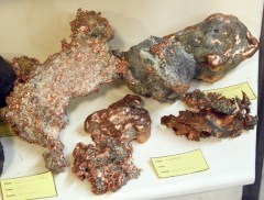
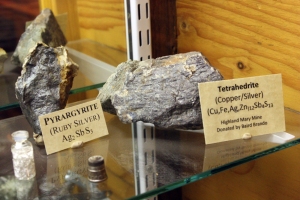
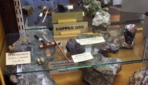
Native copper in the Creede Underground Mining Museum.
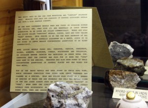
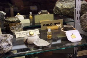
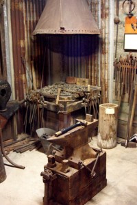
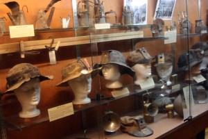
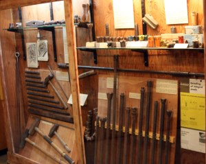
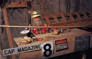
I joined a tour of the Underground Mining Museum, which was built partially from an old tunnel that has been enlarged into a loop tour, with the community center blasted out in the middle. It had a good display of minerals and posters of mining terms, with some illustrations. After videotaping the tour itself, I backtracked around the loop with my camera and took photos, so this tour is better documented than some of the others I took where I couldn’t take still photos very well while running my video camera.
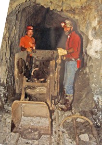
Mucker machine as it was found in the Big Six Mine.
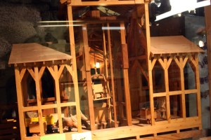
Some of the unusual aspects of this tour (which was a very thorough overview of hard rock mining) included a slusher, which is a type of dragline used to pull blasted rock fragments away from the face, a description of how fuses were measured (the person cutting fuses would wind them around wooden pegs set one foot apart), a honey car (an outhouse on wheels), an accurate recreation of a stope, a good assayer’s office, a hoist and skip station, and a description of the local geology.
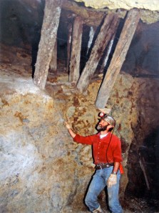
Open stope in the Big Six Mine.
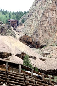
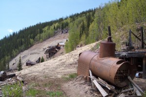
After the tour I drove further up East Willow Creek Canyon and saw the remains of the Humphreys Mill, then drove up West Willow Creek. High on the hill was the Bachelor Mine, and lower down the Commodore, with its large ore house. The slope is so steep that extensive cribbing is needed. I drove a little further up, but the gravel road became too steep and too rough for my minivan. Perhaps some other time I can come this way with a 4-wheel drive. Further up the canyon are the Amethyst and Last Chance, and I’ve found some photos of them taken by the Mining History Association.
Measuring fuses. The fuses would be wound around the peg to get precise lengths.
I drove out of town around noon and headed west and north on Highway 149. I came over a small pass with displays and beautiful views of the Weminuche Wilderness and the headwaters of the Rio Grande River. It was a nice chance to see both ends of the river. I have been down near the mouth of the Rio Grande in Laredo, Texas and now I’ve seen the other end.
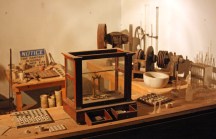
Assayer’s office, with balance, crushers, and bone crucibles. To the left is the furnace for fire assaying.
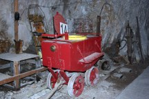
Honey car in the Creede Underground Mining Museum. OK, I’ll say it: whoever had to clean this out each day had a really crappy job. . .
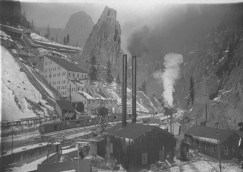
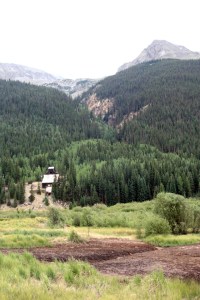
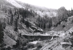
Humphreys Mill in East Willow Creek Canyon.
Site of Humphreys Mill today.
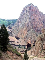
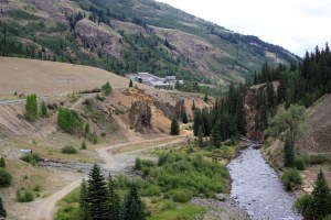
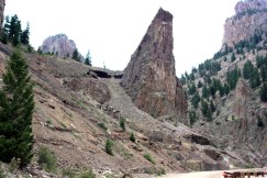
Ruins of mines in West Willow Creek Canyon. The Bachelor Mine is high up on the hillside and the Commodore Mine at the bottom.
The Bachelor Mine.
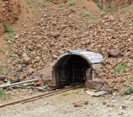
The Commodore Mine #5 Level adit.
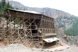
Commodore Mine ore house and chutes. Ore was hauled from the adit across a bridge to the top of the tipple.
Amethyst Mine
Last Chance Mine (photo by the Mining History Association).
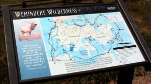
Weminuche Wilderness sign and road map.
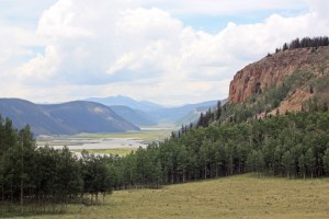
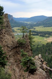
Headwaters of the Rio Grande River in Colorado.