Feeds:
Posts
Comments

Posts Tagged ‘meratus mountains’

Borneo Day 8: Friday, July 28, 2017

Group with guides by longhouse

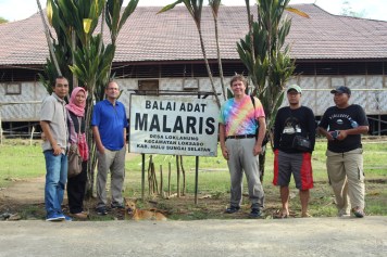
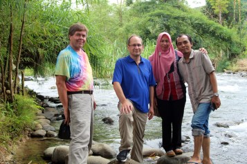
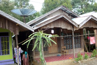
Our group posing before a traditional Dayak longhouse near Loksado. You can see that I am still wet from the bamboo raft trip. The sign says: “Malaris customary hall.” From left to right: Nazar, his wife, Craig Hendrick, myself, Amat, and Budi.

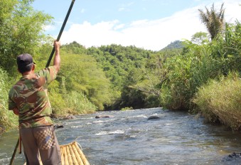
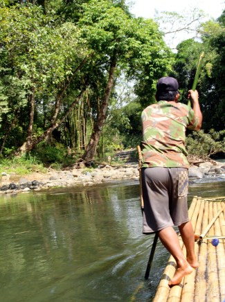
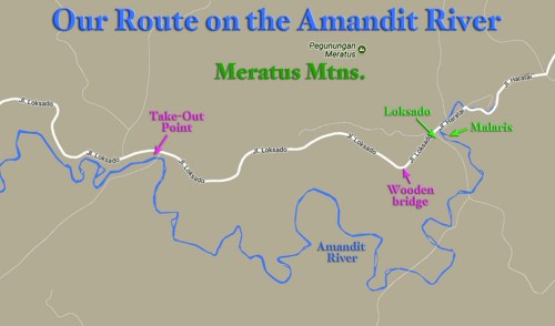
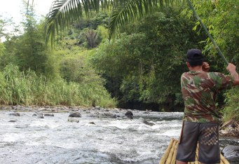
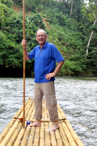
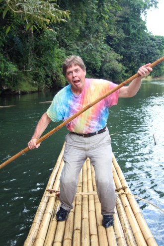
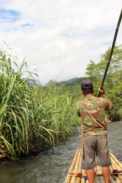
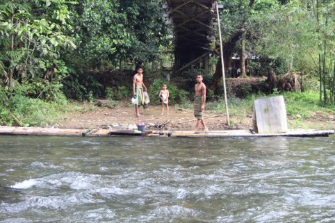
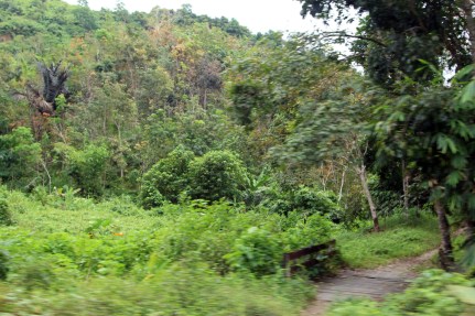
After our bamboo raft was tied up to the shore we clambered up the riverbank to a small town on the Amandit River near Loksado in Hulu Sungai Selatan Regency in South Kalimantan, Borneo. The trip down the river had been unforgettable. Now we had one more adventure yet to come on our trip to the Meratus Mountains.

Kids in doorway

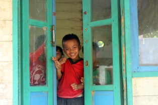
Kids in a doorway at the village where we exited the river. After a short and steep drive up a trail, we returned to the main road and headed back to Loksado.

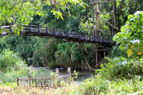
Amat and Budi were waiting for us, and we climbed into the small minivan and drove up a very primitive road, the minivan’s motor complaining, until we reached the main road. We drove over the rickety wooden bridge again – it must be stronger than it looks – and continued back to Loksado. On the sides of the road, I noticed piles of strange spikey globes which Nazar said were snake fruit. They grow wild in the rain forest here and are collected and sold to markets by the local people. I tried one when I got back to Jakarta and it was not particularly tasty and left a bitter aftertaste. Its skin peels off and looks just like a snake’s skin, hence the name.

Snake fruit pile

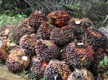
A large pile of snake fruit. It grows in large globular clumps in the rainforest and is harvested by locals. The skin peels off and is very similar in appearance to snake skin, hence the name.

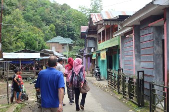
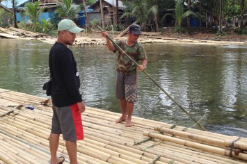
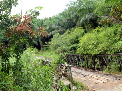
Now it was Amat’s turn to be our guide. In Loksado we drove a short distance further down the river to where a metal bridge crosses, just wide enough for one motorcycle but not our van. We crossed the bridge on foot, and it resonated with our footsteps and bounced up and down like a miniature Galloping Gertie. On the other side, we walked up a cement pathway into a Dayak village.

Crossing Galloping Gertie

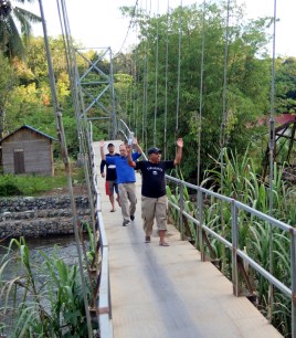
Budi, Craig, and Amat crossing the metal bridge over the Amandit River near Loksado. It resonated up and down much like the infamous Galloping Gertie.

We first stopped at the traditional longhouse. Although the people here now live in individual houses, they keep the longhouse in good condition and use it for family gatherings and ceremonies. It is a very large structure, built primarily out of bamboo and raised up on a foundation of stilts. We walked inside, and the floor joists are covered with thin strips of bamboo to make a floor, comfortable and stronger than it appears. Around the inside perimeter are a series of doors leading to small rooms for sleeping quarters of individual families, but during other times everyone joins together in the large central space. A poster on the wall described some of the ceremonies they perform here.

Dayak longhouse

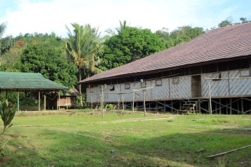
A traditional Dayak longhouse. These can be up to 150 feet long with small apartments along the inside walls and a large enclosed central space.

Since they are animists, they do not follow Muslim halal rules and eat pork. They will slaughter and roast pigs for the ceremonies. I did not follow most of what Amat said, translated through Nazar, but did record video of it that I hopefully can go through later.

Dayak longhouse 2

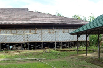
The other half of the longhouse. They are built up on stilts and made mostly of bamboo, which is plentiful in the rainforest, grows quickly, and is used for most construction.

We continued to walk up the road to the village, passing the houses and people as we went. Peccaries (a type of small pig), chickens, and dogs roamed around. A motorcycle passed laden with bundles of reddish sticks. Then we saw a group of ladies sitting on a porch scraping the bark off of more sticks with knives. Shavings of bark lay around the porch, and the aroma was heavenly. It was cinnamon. Further on, a small fenced off patch had small cinnamon tree seedlings growing in it, protected from the pigs and chickens. The trees themselves are grown away from the village – we didn’t see where – and harvested when they reach a large enough size. To think I’ve used cinnamon to season my bread and desserts which may have been scraped off on this very porch. Such is the nature of this strangely small and interdependent world.

Inside longhouse

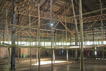
Interior construction of the longhouse. Apartments line the outer walls and face toward this large central area. The floor is made from bamboo slats. Hardwood pillars and stilts support the structure.

This seems like an idyllic village, with men playing card games and women plaiting baskets and animals wandering around. Yet the Dayak people have a violent past; they were known as headhunters and ferocious warriors. The Iban, or Sea Dayak, were feared pirates and raiders. There are about 50 sub-groups and separate tribes speaking up to 170 different dialects, some only spoken by a few hundred people today.

Kalimantan_Ethnic_Groups

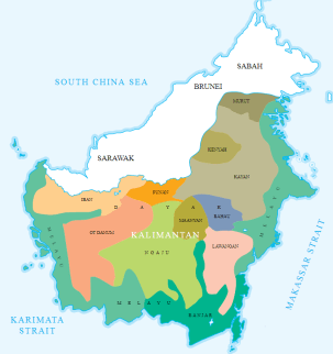
There are about 50 different tribal groups of Dayak people in Borneo. This diagram shows the major groups living in Kalimantan (Indonesian Borneo). The Banjar and Melayu peoples, related more to ethnic Malay groups, live along the coastal rivers. The Dayak inhabit the mountainous interior. The group we visited were of the Lawangan tribe (pink area) in the Meratus Mountains of southeast Borneo.

Although headhunting was outlawed by an inter-tribal peace treaty in 1874, there have been resurgences such as during World War II when Allied soldiers trained Dayak tribesmen in guerilla warfare against the occupying Japanese and encouraged a return to headhunting. Isolated incidents have occurred as recently as the 1990s.

Living in the rainforest, the tribes established sustainable practices without having to cut down trees. They believe in a life force called Semangat that is present in all people, animals, plants, and even in the water, rocks, and mountains. It is especially potent in the heads of executed enemies, and collecting them was essential for many village ceremonies and for a warrior’s status.

Dayak tribesman-1920

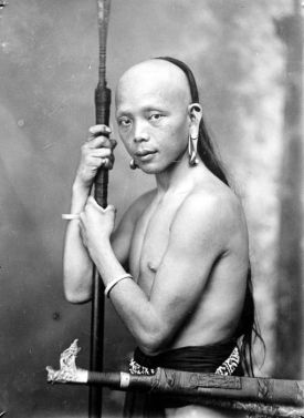
Photo of a Dayak warrior in the 1920s. Notice the elongated earlobes.

This belief in Semangat led the Dayak tribes to live in sustainable harmony with the rainforest around them. You could say they invented the Green Revolution, and we can learn a great deal from them. Yet because of economic forces and unscrupulous officials, over 30% of Borneo’s rainforest has been cut down for the hardwood trees and planted to palm oil and rubber. Here is an excellent article on the Dayak peoples: https://www.indoneo.com/en/travel/meet-the-dayaks-ex-headhunters-of-borneo/

Scraping cinnamon

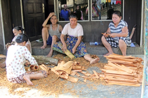
Scraping the bark off of cinnamon trees. This is dried, ground up, and sold throughout the world. The aroma was heavenly!

Pig and dog and chicken

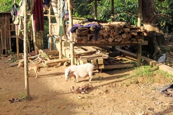
A peccary, a type of small pig, with dog, in a Dayak village near Loksado. Since Dayak peoples are animists or have converted to Christianity, they do not follow Muslim halal practices. The pigs are roasted for many ceremonies.

Beyond the village we came to a very sketchy wooden bridge across the river, which looked like the one out of The Emperor’s New Groove. Some of the slats had large gaps between them. We walked carefully across and continued up a path along the other side of the river. We saw a waterfall ahead, and had to use ropes to scramble over some slippery rocks next to the river to reach the waterfall, where we took photos. It was a very peaceful place.

Rain forest path

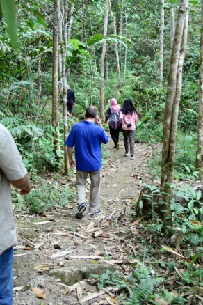
Walking through the rainforest toward the waterfall.

There was one thing that marred the beauty. Visitors had left trash behind. Not much, but there shouldn’t have been any. I’ve seen the same thing – piles of garbage left behind – in Hobble Creek Canyon near where I live in Utah. You would think we would all know better than this by now. I know I am trying to write generative stories here, not negative ones, so let me just say if you ever do visit a beautiful place, don’t spoil it by leaving trash. Please pick up after yourself. In fact, pick up more than you bring and gradually we can clean up the messes we’ve left. I picked up as many pieces as I could and carried them out in my pockets.

David by waterfall

David Black posing near the waterfall at the headwaters of the Amandit River in Borneo.

On the way down the path I noticed rubber trees by the pathway blending in with the forest. They were being harvested. To gather the natural latex, a slit is carved near the bottom on one side of the tree, sloping downwards around half of the tree. A leaf is driven stem first into a small hole made in the tree at the end of the slit, and the white latex collects in the slit, flows downward to the leaf, and drips off of the tip of it into a blue cup placed on the ground. It is a slow process, with only a few drips per day as the sap rises through the bark of the rubber tree. The latex is collected and processed. As the tree grows, the slit at the bottom moves up and a new slit is made below the old one. Some of the larger trees had about six to ten inches of slits moving down their trunks.

Mature rubber tree with slits

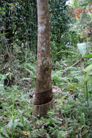
Mature rubber tree with a series of slits near the bottom. The white latex rubber sap oozes out of the lowest slit as it rises into the tree, then flows down the groove, out onto a leaf, and drips into a small cup for collection. The slits are carved only around half the trunk, or they will kill the tree.

We walked back over the wooden bridge and back down through the village. Two ladies were mending nets and weaving a basket on their porch, which I photographed. A small green building at the bottom of the village was labeled as “Taman Kanak Kanak” or Kindergarten. I saw no other schools around.

Latex drips off leaf

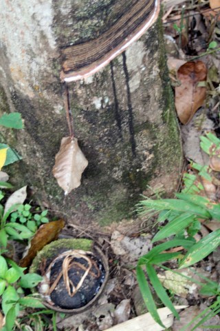
The white latex rubber flows along the groove of the lowest slit, then out onto the leaf, where it drips into the small cup for collection. Only a few drips fall each day.

We crossed back over the metal bridge, climbed into the minivan, and drove back up to Loksado, where we said goodbye to Amat. It was just sunset as we drove away, the end of the day coming early in the tropics. As we drove back over the winding road, I took a few final photos of the sacred Meratus Mountains.

Playing board game

Villagers playing a board game.

On the way back, we stopped again at another small town for late evening prayers, then in Kandangan to have a local popular dish for supper, called ketupat kandangan. It is steamed rice formed into triangular lumps and cooked in sweetened coconut milk, with fish or salty boiled eggs added. It was good, but I wasn’t a fan of the eggs. Then we climbed back into the minivan and headed back to Banjarmasin. My feet were still wet from rafting on the river (as well as my behind and legs) and my right leg was not very happy with being cramped up again. It was a long drive and I could only sleep fitfully, trying to change position to get my leg comfortable but without much success. But the discomfort was worth it for what had been an incredible day.

David in bamboo hut

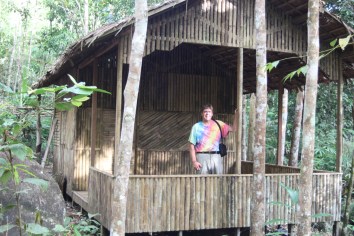
This bamboo hut was along the trail to the waterfall. Almost everything here is built out of bamboo.

We arrived back at the hotel around 11:30. I crashed in bed as soon as I got to my room, barely taking enough time to get undressed and take my contact lenses out. I was glad for being able to sleep in the next day.

Weaving net and basket

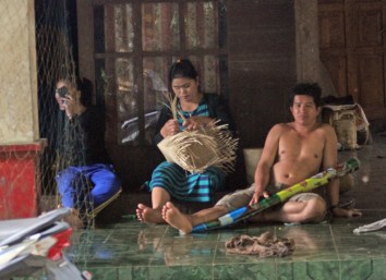
Tending to nets and weaving a basket. The man is making a traditional musical instrument.

What a day this has been! My dreams of what to see and do in Borneo have all been realized. This was a long day, what with eight hours of driving, but it was so very worth it. I am grateful for what Nazar did to set up this trip, to Budi for driving and knowing all the right people and places to go, for Amat for his knowledge of the local people, and to Amli for guiding us down the river. I will never forget this day.

Chickens crossing road

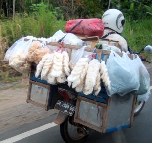
So, why did the chickens cross the road?

Cinnamon tree seedlings

Cinnamon tree seedlings, fenced in to protect them from the roaming peccaries.

Rain forest at sunset

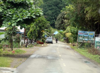
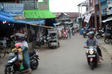
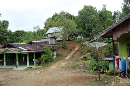
The road back to Loksado from the metal bridge that leads to Malaris.

Sacred mountain sunset

Sacred mountain sunset.

Sacred mountain

Sacred mountain in the Meratus Mountains of Borneo.

Rice and egg in coconut milk

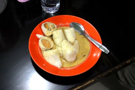
Ketupat Kandangan, a local favorite dish made from lumps of steamed rice cooked in sweetened coconut milk. The boiled eggs were a bit too salty, but otherwise the dish was delicious.

Read Full Post »

Borneo Day 8: Friday, July 28, 2017

Bamboo raft on Amandit River

Amli, our guide, poling the raft through the rapids on the Amandit River in Meratus Mountains of southeast Borneo near Loksado.

This post describes one of the most incredible adventures of my life: a journey on a bamboo raft down a whitewater river through the rain forest in the mountains of southeast Borneo. We began in the village of Loksado high in the Meratus Mountains.

Walking to raft

Walking through the village of Loksado on our way to the starting point of our rafting trip.

Upon arrival at Loksado in Hulu Sengai Selatan Regency, we were greeted by our local guide named Amat. He had lived in the area for several years and knew the rafters well. He in turn introduced us to Amli, who would be our rafter and guide down the Amandit River.

David-Craig-Nazar-wife ready to raft

Myself, Craig Hendrick, Nazar and his wife at the headwaters of the Amandit River in Loksado, Borneo.

Loksado is a small village situated in the rain forest near the headwaters of the river, which is fairly shallow but runs over many small rapids on its way down through the hills. The local people have developed a style of raft that is ideally suited to these conditions. They take local bamboo, which is plentiful, and dry it for several months on the banks of the river. They then take strips of bamboo bark and use it like rawhide to bind the poles together in a flat bundle about 20 poles wide and maybe 25 feet long, slightly upturned at the front end. In the middle they build a seat that is large enough for three people although not very tall or comfortable. They then use a bamboo pole about ten feet long to push and steer the raft down the river.

Amli and organizer preparing

Amat and Amli preparing our raft for departure.

We climbed over the drying bamboo to reach our raft. I brought a plastic bag to wrap my camera bag inside, knowing it was likely to get wet, and kept my camera strap around my neck as we set off. Craig sat in front, I in the middle, and Nazar behind as Amli pushed off from the bank.

Starting out

Amli uses a bamboo pole to push us off from the bank as we begin our journey down the Amandit River in southeast Borneo.

The raft is not designed to stay dry, merely to skim the top of the water, staying shallow in draft and supporting the weight of 3-4 people. Water flowed over the bamboo logs and between them freely, and the whole raft was as flexible as a bundle of drinking straws. In fact, I think I will have my students use drinking straws to build models of the raft and use them to race down “rivers” we will make. This could be a nice engineering project: design a raft from wooden skewers or drinking straws that is flexible, able to handle a shallow river and run between the rocks in rapids, yet capable of supporting quite a bit of weight. No inflatable rubber rafts allowed. I couldn’t help but think how much my brother in law, Levi, who was a recreation major in college, an expert river rafter, and a professional photographer would enjoy this experience.

Raft construction

After 20 minutes on the river, we pulled over to transfer to a larger raft. I was able to get some close-up views of how the rafts are constructed. Bamboo logs about 20 feet long are tied together with strips of green bark tied to crosspieces, with a slight inward curve at each end. The seat is built as a piece and strapped onto the deck and will hold three people, although not very comfortably. A bamboo pole about eight feet long is used to push the raft along. The river is fairly shallow, with frequent rapids, and this style of construction allows the rafts to hold a great deal of weight while maintaining flexibility and a shallow draft. This is the only type of boat that can navigate this river.

We traveled down through several small rapids and calm spots for about 20 minutes. There were developed areas, built up embankments, and a few resorts along the river. We stopped at one of these, and I thought the trip was done. But we were only changing rafts for a bigger model. Once we had moved to the new raft, we set out again.

Amli poling raft

Amli poles the raft ahead through a calm area. He plants the bamboo pole into the riverbed, then pushes on the pole while walking backward on the long front section of the raft, thus propelling the raft forward.

We left all signs of civilization behind. There were no more villages or signs of people except for an occasional wooden or bamboo bridge across the river and a few huts where people had tried to farm. Most of the time, we saw nothing to mark the wilderness. This was the rain forest that I had come to see, and each bend in the river brought more incredible views with such rich shades of green that my eyes could hardly take them in. Usually we could not see beyond the plants growing along the river, but from time to time views of mountains and clouds and tall jungle canopies presented themselves. The sky had been overcast from the morning rain, but soon cleared to a brilliant blue broken by fluffy cumulous.

Amandit River view

View along the Amandit River in the Meratus Mountains of southeast Borneo. There were frequent rapids interspersed by short sections of calm water. No photos can adequately capture the intense greens of the rain forest canopy as we rode deeper into the wilderness.

Most of the plants we saw were bananas, coconuts, rubber trees, and a plant that looked very much like sugar cane but wasn’t. There were thick trees with tangled roots hanging over the river, and thick bundles of bamboo growing very tall. Some trees with whitish trunks grew up over 70 feet, competing with the coconut trees for the top of the canopy. There were ferns and cycads and many other plants I couldn’t identify.

Loksado area-s

A map of the Amandit River and our route through the rainforest. We started at Loksado and floated down the river past several small bridges (marked here where the paths intersect the river). It took us two hours to reach the take-out point. The Dayak village we visited (see the next post) was across the river from Loksado in Malaris.

At one point I heard a small sound and spied a large, black lizard climbing out of the water. I took some photos of it but none of them turned out to where you could tell what it was.

Approaching rapids

Amli guides the raft expertly between the rocks as we approach a series of rapids. He knew every rock and bend in the river and how to navigate the large raft along the main currents.

Amli navigated the raft expertly between the rocks of each rapid we traversed. He obviously knew this river well, and steered us through the main channel. When we reached a calm spot, he would push the raft by sticking his pole into the sand below, then walking backward on the raft, pushing the pole to propel us forward. Where the water was too deep (he showed us this by pushing the pole deep into the water and having it float back up) he used the pole like a paddle. In the rapids and along the banks, he used the pole to push off rocks.

Meratus mountain view

A view of the Meratus Mountains as seen from the Amandit River in southeast Borneo. This was an unusual gap in the canopy; in most areas, the coconut, bamboo, and banana trees crowded the banks.

I wish I could adequately use words to describe the beauty and vibrant sense of life along the river. It was a two-hour trip that I will never forget. We were the only ones rafting today, and Amli said it varies from day to day how many people come. The governor of the province has built one of the resorts in Loksado, but it seems under utilized or advertised as no one seemed to be there. There are very few professional tour guides and no public transportation that reaches here; you have to know someone who is a friend of the local people such as Amat to arrange this and who can drive you from Banjarmasin, which has the closest airport and major hotels. I have to hand it to Nazar for having these connections and setting this up. This is a major potential tourist destination that is virtually unknown. This is the first time he has ever done rafting before. This should not surprise me; there are many people in Utah who have never rafted the Green River either, and it takes about the same amount of time to get there. You also need connections to rent the rafts and get the gear.

Around the river bend

The rain forest canopy leans over the Amandit River as we round a bend.

As we traveled further down the river another hour we began to see more signs of human activity. There were occasional cleared areas with small huts along the hillsides. Amli explained that local people use slash and burn methods to clear the rain forest, then plant cassava in the clearings. Since the jungle is gone which holds in the soil, rain will wash down into the river along with any nutrients the soil holds, and the cassava fields will only grow for a few years before new areas must be cleared.

Cassava slash and burn

Slash and burn agriculture along the Amandit River in the rain forest of southeast Borneo. The green plants behind the hut are cassava, which quickly deplete the soil so that new swathes must be cleared by burning down the trees. The bare area to the left is ready for planting more cassava. Much of Borneo’s rainforest is quickly disappearing due to slash and burn agriculture or for the planting of palm oil plantations.

We saw more frequent bridges and a few small villages. A man and his wife passed us pushing their raft up the river. These people may seem lost in a remote wilderness, but they want the same comforts as us all. One hopeful point is that they are using solar voltaic cells to power their homes. They are about as far off the grid as it gets.

The old bridge

As we traveled further down the river, the signs of civilization became more frequent, such as this old bridge leading to a few huts along the river. It reminds me of the bridge in Emperor’s New Groove.

We asked if we could pose with the bamboo pole, and Amli told us to wait until we reached a long calm spot, then we traded places on the raft to pose. It is like trying to stand up in a kayak, but a bit more stable. I was beginning to get sunburned – I brought sunscreen to Kalimantan with me, but forgot to apply it today even though I did put on a thick coat of bug spray. The sun was hot but the air was cool and refreshing, much nicer than the humidity down in the lowlands and I didn’t realize I was getting sunburned until it was too late.

Craig with pole

Craig Hendrick posing on the raft. We asked Amli if we could take a turn at pushing the raft. He waited until a quiet spot and let us pose. It is trickier than it looks to keep your balance on the flexible raft. Notice how the water comes up through the bamboo poles.

After two hours on the river we reached a group of houses and another bridge and Amli pushed us to the shore, where Amat and Budi waited for us. We clambered off the raft and climbed up to the waiting minivan. I had kept my black shoes on, and they and the bottom part of my pants and my butt were soaked from the water splashing onto the raft as we ran the rapids. But I didn’t care if I was a bit squishy.

We're in trouble now

We’re in trouble now! It’s harder than you might think to balance on these flexible rafts. Sitting on the central seat, water would often splash up as we shot down the rapids and I got a bit wet. Looks like I had an accident. These shoes were already worn out, so I threw them away after this journey.

I would recommend this rafting trip to anyone with the means to arrange it. We paid a very small price for an unforgettable experience. I will treasure the hundreds of photos and video clips I took. I had to keep mentally pinching myself all the way down the river because I thought I must be dreaming, and in my dreams will frequently return to this voyage through the rainforest on a bamboo raft. When I think that someone from a small town in the desert of western Utah could ever be in a tropical rainforest, doing what I’ve done today; I would never have believed it.

Rocks in river

Rocks and rapids along the Amandit River in southeast Borneo. I still cannot believe I had the opportunity to do this!

David with pole

I don’t think I’m doing this quite right. It takes practice and balance to pole the raft along. I got a bit sunburnt but the air was refreshingly cool as we traveled along the river.

Rain forest

Another view of the rainforest along the Amandit River. As nice as these photos are, they cannot convey the sense of brilliant green life surrounding the river.

Poling up the river

A husband and wife team poling their raft up the river. These were the only people we saw going upstream, and this only at the lower end of the river.

Poling raft in rain forest

The plants along the river here look very similar to sugarcane but are not. In some areas the banks were relatively flat, in others steep and overhung with trees.

Kids with raft

Children playing with their own raft at a village along the Amandit River.

Coconut canopy

Coconut palms form a major part of the rainforest canopy along the Amandit River in southeast Borneo.

Bamboo canopy

Bamboo grows profusely along the river, along with wild coconut and banana trees. There is a plant that also looks like sugarcane but isn’t, and tall, thin trees such as this one with tannish gray trunks.

Bridge at take out point

As we traveled down the river, villages and bridges became more numerous as the river curved back toward the main road. Once we reached this point, after two hours on the river, we pushed to the side of the stream and climbed out

Read Full Post »

Borneo Day 8: Friday, July 28, 2017

Snacks on motorcycle

On our way to the Meratus Mountains, we traveled along the Jalan Achmed Yani through Martapura and on to Rantau and Kandangan. The road was busy, and we passed people on their way to market. This person is carrying an entire snack stand on his motorcycle.

Today was the most amazing experience we have had so far, and that is saying something. We traveled to Loksado, a four-hour journey into the Meratus Mountains, floated down the Amandit River through a tropical rain forest on a bamboo raft, walked to a Dayak village and a waterfall, saw rubber plantations and cinnamon trees, and ate some great Indonesian dishes.

Banjarmasin combo-s

A satellite image of the Banjarmasin area of southern Borneo overlaid on a 3D model using data from the USGS Earth Explorer website. The route to Loksado took us through Banjarbaru and Martapura and turned to the northeast, paralleling the Meratus Mountains through Rentau and Kandangan, where we turned into the mountains to Loksado.

When I first sent a list of possible things we’d like to do to Nazar back in May, I asked rather timidly if it were possible to visit the Dayak people and Meratus Mountains. He responded that it would take two days to do and would not work in our schedule. I knew that was likely to be the case, so I accepted his reasons.

But when we landed at the airport, he told us that he had made a change in the schedule and got permission from the headmaster for us to miss school on Friday to go to Loksado after all. He had to still work out some details and negotiate a cost with a friend who would be our guide, and he would have us pay for the trip, which we willingly agreed to.

Loksado area

The area around Loksado, showing the main road (in white) and the path of the Amandit River, which we rafted along. Loksado does’t even show up as a village.

After a few days here, he told us he had worked out the details and the total cost, for three people on the raft, and gas, meals, and guides for six people would be $150 U.S. An incredible deal! I still can’t believe it was only that much. Craig and I divided the cost so it only came to $75 each, which is about one million rupiah.

Main highway

This is the main highway from Martapura through Rantau and Kandangan. Sometimes it is wider (about three lanes worth) and usually it had much more traffic than at this spot.

Here is what the Swiss Belhotel website has to say about Loksado:

Isolated area located in South Kalimantan is popular by the name Loksado, a sub-district in Regency of headwater of South River which became a Dayak Tribe’s house where they can live everlasting with the splendid landscape. To reach out this place, you will explore the heart of Meratus highlands about two and a half hours from Banjarmasin, the capital of South Kalimantan. Next, be ready to get drift with the magnificence panorama of tropical forest which decorated with waterfall and rivers that split the forest.

Despite some English problems, you can get the idea that this is an amazing place. Loksado is located in the Hulu Sungai Selatan Regency. Indonesia is divided into provinces, which are somewhat equivalent to our states but not as independent from the federal government. Each province is divided into regencies, which are like counties. Banjarmasin is the largest city in its regency. The school in Mandastana is in Kuala Barito regency.

Mother and daughter

A mother and daughter on their way to market in Rentau.

Nazar’s friend and our driver, Budi, picked us all up at the hotel at 8:30. There were six of us in a small minivan: Budi and Nazar in the front seats, Craig and I in the middle, and Nazar’s wife and oldest daughter in the back. We headed southeast out of Banjarmasin on the main road past the airport, east through Banjarbaru and Martapura, and onward. The road turned toward the northeast as we got closer to the southern hills of the Meratus Mountains. It was cramped, and my right leg started to hurt, but with some isotonic exercises I was able to endure. The road had two full lanes with just enough room for two cars to pass each other, but often there were motorcycles zooming in and out, or we were passing one, or trying to pass a slower truck or car. Budi would announce his intent to pass with a beep of the car’s horn, as if to say “On your right!” or “Get over!” Sometimes there were close calls as motorcycles (or us) narrowly escaped being caught by oncoming traffic. Yet somehow it all worked and we saw no accidents, or even crumpled fenders.

Rantau marketplace

The marketplace in Rentau. You can always tell a market because the motorcycles are packed together and it is the busiest part of any town in the mornings.

The road was elevated above the countryside and houses had been built along it on stilts to keep them above the low-lying swampy ground. I tried to take some photos through the window, but most of them turned out blurry. We passed through the larger town of Rantau, with busy marketplaces and mosques, then continued on. I was longing to stretch my leg, but by changing positions frequently was able to make do.

Rubber plantation

A plantation of rubber trees. These are too small to start harvesting the latex sap, but will be large enough in a few years. As we got to more hilly ground, these plantations became numerous.

The surrounding countryside became more hilly and I started to see we were passing groves of thin trees with mottled trunks of grey, tan, and green, planted in even rows. Nazar told me that they were rubber trees. A bonus! I’d wanted to see a rubber plantation, and here we were driving through them. They don’t like to grow in the low lying areas, which are more wet and used for rice cultivation, so they became more frequent as we approached the hills. There were also palm tree groves, used for making palm oil.

Coal boss house

Guarded gateway for one of the coal boss houses. This is one of the mansions we saw on our way to Loksado.

In some of the small towns along the way we saw enormous, ornate houses. Budi told us that these were the houses of the coal bosses, who own and run the large coal mines in the area. The coal deposits are in the foothills of the Meratus Mountains and a series of unpaved private roads has been built to transport the coal to the Barito River or to the sea for loading on barges, like the ones we’d seen on the river. Green trucks could be seen driving along these roads as we passed over them on bridges. Before these roads were built, the trucks used the highway we were on (the only one in the area) and it had caused bad congestion and many accidents.

Coal road

One of the roads built specifically to transport coal from the mines in the mountains to the Barito River, where it can be shipped by barge to ports. I had seen the barges, now I saw the trucks.

We crossed into Hula Sungai Selatan Regency and the main city of Kangangan. It started to rain heavily as we reached the city, but let up enough for us to leave the car. We stopped at a restaurant in the marketplace and ate ayam goreng (fried chicken) with green chili sauce, rice, seaweed (I think), cucumber slices, and a sprig of a mint plant served on a banana leaf. We ate it with our right hands. It was very tasty and I quite liked the green chili sambal. It was good to stretch my leg.

Buka-open

Kandangan after the rain. We stopped for ayam goreng (fried chicken) at a restaurant here.

Beyond Kandangan we turned into an even narrower road toward the east. Before long, it wound up into the foothills and wound through small villages. We rolled down the windows and enjoyed the cooler, freshly washed air. The call to noonday prayer was beginning, and Budi wanted to stop since this is the most important Friday prayer. After passing several mosques we stopped in a small village along the road at a mosque Budi was familiar with. Nazar, his wife, and Budi went into the mosque to pray while we walked around the village and took photos. I found it incongruous that the somewhat primitive looking houses had satellite dishes on their roofs. Chickens and baby chicks wandered around, roosters crowed, and we took photos of the houses and children. Then I heard a strange call coming from behind us, of some exotic bird (I thought). I walked back and discovered it was coming from a wooden cage we had passed. It was a dark grey monkey with lighter fur around its eyes. I also saw what looked like a cacao tree nearby.

Pausing for prayer

We paused in a small mountain village for noontime prayers at a small mosque. While the others were praying, Craig, Nazar’s daughter, and I explored the town.

After prayer, we continued into the mountains. The road became steep in places, taxing the power of the small minivan. The forest grew more lush and green, and we passed mountains and streams, crossed wooden bridges that I wouldn’t have dared to walk across, let alone drive a car, and finally arrived at Loksado, a small village at the headwaters of the Amandit River.

Incongruity

Houses in a village in the Meratus Mountains. The houses here were of different design and construction than the Banjarese houses along the rivers in the south. The satellite dish is a bit of an incongruity.

It had been a fascinating drive, seeing more of the countryside and everyday life of villages and towns in the hills. Now it was time for yet another adventure.

Village in mountains

Houses in a mountain village where we paused for noontime prayers. Notice the satellite dish – these remote towns are not without their modern conveniences.

Mountain village shy kids

Shy kids in a village in the Meratus Mountains.

Small town mosque

Small mosque in a village in the Meratus Mountains. The noontime prayer was being called as we traveled through these villages, so we stopped for prayers and explored the village.

Banana trees

Banana trees in a village in the Meratus Mountains of south east Borneo.

Bend in the road

Past the village where we stopped for prayers, the road became more twisting and the scenery more lush and green

Approaching mountains

Pathway into the rain forest. As we drove further into the mountains, the lush greenery rose on hillsides around us and small paths like this one beckoned us to explore.

Bridge to cross

One more bridge to cross before we reach Loksado. And this is the main highway . . .


Read Full Post »

Borneo Day 2: Saturday, July 22, 2017

House on the hill

The house on the hill. Construction workers were cutting off the top of this hill to make room for more houses and tried to blow up this house. Each time they tried, something went wrong or the workers got sick. They decided the house was haunted and just left it while digging all the other dirt away. Now it’s become a tourist destination.

On our way to the diamond mines we stopped at a recent local landmark of sorts: the haunted house on the hill.

Near Banjarbaru a new subdivision of houses is being built, and they are leveling out a hillside to make more. As they cut into the hill, they had to tear down some existing shacks and buildings. Once such house was set to be destroyed by dynamite but the dynamite never went off. The construction workers, being somewhat superstitious, felt this meant the house was haunted and the ghosts didn’t want the house blown up. Another story is that every time a construction worker tried to tear it down, the worker got sick.

Hmmm

Hmmm . . . something’s not right here . . .

So they left the house there, sitting on the hill, and dug the hill out from around it. It now sits on a pillar of dirt and rocks about 20 feet high and just wide enough for the house. It is a bizarre sight that Nazar thought we would enjoy. It has become a popular new attraction and is being called Rumah Jomblo, or the Single House.

We drove in through the new houses and parked at the foot of the hill at the base of the pillar upon which the house sits. We walked around and climbed up to the top level and took photos. Craig created and posted a Google 360 image of the house, which I haven’t been able to find or I would provide the link. Craig took some photos of me in front of the house as well.

This is a very temporary attraction, as the pillar of soil will erode away after a few rainy seasons and the house will inevitably fall, ghosts or no ghosts. They canna’ change the laws o’ physics.

At house on hill

At the haunted house that sits on a pillar of dirt near Banjarbaru.

From a geology standpoint, I was interested in the muddy orange soil that seems ubiquitous throughout this part of Kalimantan. It has a lot of iron-rich clay with rounded gravel, a delta deposit if I ever saw one. These deposits were laid down when sea levels were higher during the Cretaceous Period, and are now the hills around Banjarbaru. From our view on the hill we could see the new provincial administration building a few miles away as well as the Meratus Mountains.

We were close to the diamond mines, our next stop.

Read Full Post »